Possibility question ...

Just starting out? Need help? Post your questions and find answers here.
PureLust
Posts: 4
Joined: Mon Dec 09, 2024 1:50 pm

Possibility question ...

Post by PureLust »

Hi ... I plan to purchase Spider Basic to realize a little Project:

For my Offroad Motorcycle Trips, I want do develop an app, where I can set some GPS marks into a DataBase to process them later on.
For this I would like to have the following functions, where I do not know if Spider Basic does support them:

1) access to GPS data/coordinates - (100% must have)
2) UI possibility to "view over other Apps" (to access my UI, even-though another Navigation-App is showing) - (90% must have)
3) Share/Transfer Data to other Devices/PC - (would be nice)
4) Access/view Streetmap-Data from Google-Maps or OSM (Open Street Map) including map rendering - (totally optional, but would be great if possible)

I think, all the other necessary functions are definitely included in Spider Basic (like DataBase for Data Storage, etc.).

Maybe someone can help me with that? ;)

Thanks and greets, PureLust.
User avatar
Caronte3D
Posts: 189
Joined: Sat Nov 23, 2019 5:21 pm
Location: Some Universe

Re: Possibility question ...

Post by Caronte3D »

1.- Yes you can.
2.- I don't understand this point, but sounds difficult to me.
3.- With an intermediate server, yes, you can, but for p2p sounds difficult (maybe a cordova bluetooth plugin works? I don't know).
4.- Yes you can.

Btw, I'm doing now a GPS app for my offroad routes:
https://prnt.sc/Ek5q7CkWK0qS
Fred
Site Admin
Posts: 1820
Joined: Mon Feb 24, 2014 10:51 am

Re: Possibility question ...

Post by Fred »

There is a free version so you can toy with it and see if it works for you. About the 2nd point, I don't know if cordova manage overlays. How would it looks ? A floating button or something ? Or a notification you can click on in the system pull down menu ?
User avatar
Caronte3D
Posts: 189
Joined: Sat Nov 23, 2019 5:21 pm
Location: Some Universe

Re: Possibility question ...

Post by Caronte3D »

Many smartphone nowadays allow split the screen, so you can put two apps at once. May be a workaround.
Dirk Geppert
Posts: 332
Joined: Fri Sep 22, 2017 7:02 am

Re: Possibility question ...

Post by Dirk Geppert »

Interesting project, please keep us up to date here :)

@Caronte3D: Did you build this with the new MobileUI? It looks very promising.
What exactly are you doing with it?

I'm also in the process of building a tool for my motorcycle tours.
But my intention is going in a slightly different direction.

I'm building a tool that uses the browser function for sound recording and transcribing so that I can take notes while I'm riding if I see something interesting.

The note should then also contain the date, time and current geoposition. However, I have noticed that the location using the browser (WebApp) is not particularly accurate.
User avatar
Caronte3D
Posts: 189
Joined: Sat Nov 23, 2019 5:21 pm
Location: Some Universe

Re: Possibility question ...

Post by Caronte3D »

Dirk Geppert wrote: Tue Dec 10, 2024 11:53 am @Caronte3D: Did you build this with the new MobileUI? It looks very promising.
I was doing many parts with the new MobileUI but also with html/Js/Css because the MobileUI is a bite limited sometimes, if you want to do things not supported. The nice part is you can do almost anything.
Dirk Geppert wrote: Tue Dec 10, 2024 11:53 am What exactly are you doing with it?
It's an app to follow gpx routes with indications turn by turn on offroad environments, so the voice indications are curve based, because I don't use roads, only narrow trails.
Dirk Geppert wrote: Tue Dec 10, 2024 11:53 am I'm also in the process of building a tool for my motorcycle tours.
But my intention is going in a slightly different direction.
I'm building a tool that...
Interesting
Dirk Geppert wrote: Tue Dec 10, 2024 11:53 am However, I have noticed that the location using the browser (WebApp) is not particularly accurate.
To achieve good location accuracy, a good smartphone is needed and signals outside an accuracy limit should be filtered out. It would also be better to combine several values ​​and get the averages. Accuracy improves in open environments and time should be allowed to get good signals (accuracy is poor at first).
Dirk Geppert
Posts: 332
Joined: Fri Sep 22, 2017 7:02 am

Re: Possibility question ...

Post by Dirk Geppert »

Caronte3D wrote: Tue Dec 10, 2024 4:32 pm To achieve good location accuracy, a good smartphone is needed and signals outside an accuracy limit should be filtered out. It would also be better to combine several values ​​and get the averages. Accuracy improves in open environments and time should be allowed to get good signals (accuracy is poor at first).
Yes, the accuracy improves the longer the location of the device is active. This is probably also the problem with browser-triggered tracking, which is usually only carried out selectively on request and not continuously as in apps.
User avatar
Caronte3D
Posts: 189
Joined: Sat Nov 23, 2019 5:21 pm
Location: Some Universe

Re: Possibility question ...

Post by Caronte3D »

Dirk Geppert wrote: Wed Dec 11, 2024 7:26 am ...which is usually only carried out selectively on request and not continuously as in apps.
I don't think so, if you use: StartGeolocation() you should get the updated values until you call StopGeolocation()

I'm testing my app now and... the accuracy is good sometimes <10meters
PureLust
Posts: 4
Joined: Mon Dec 09, 2024 1:50 pm

Re: Possibility question ...

Post by PureLust »

Thank you guys for your reply. :)

@Fred:
There is a free version so you can toy with it and see if it works for you.
- I thought there where some limitations for the free Version - especially when it comes to generate Apps. :shock: I'll have a closer look into it, thanks. :D
About the 2nd point, I don't know if cordova manage overlays. How would it looks ? A floating button or something ? Or a notification you can click on in the system pull down menu ?
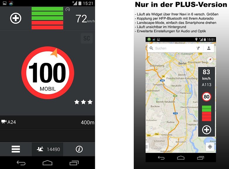
- These Overlays are like litte 'always on top' Widgets, floating above all other applications. e.g.:

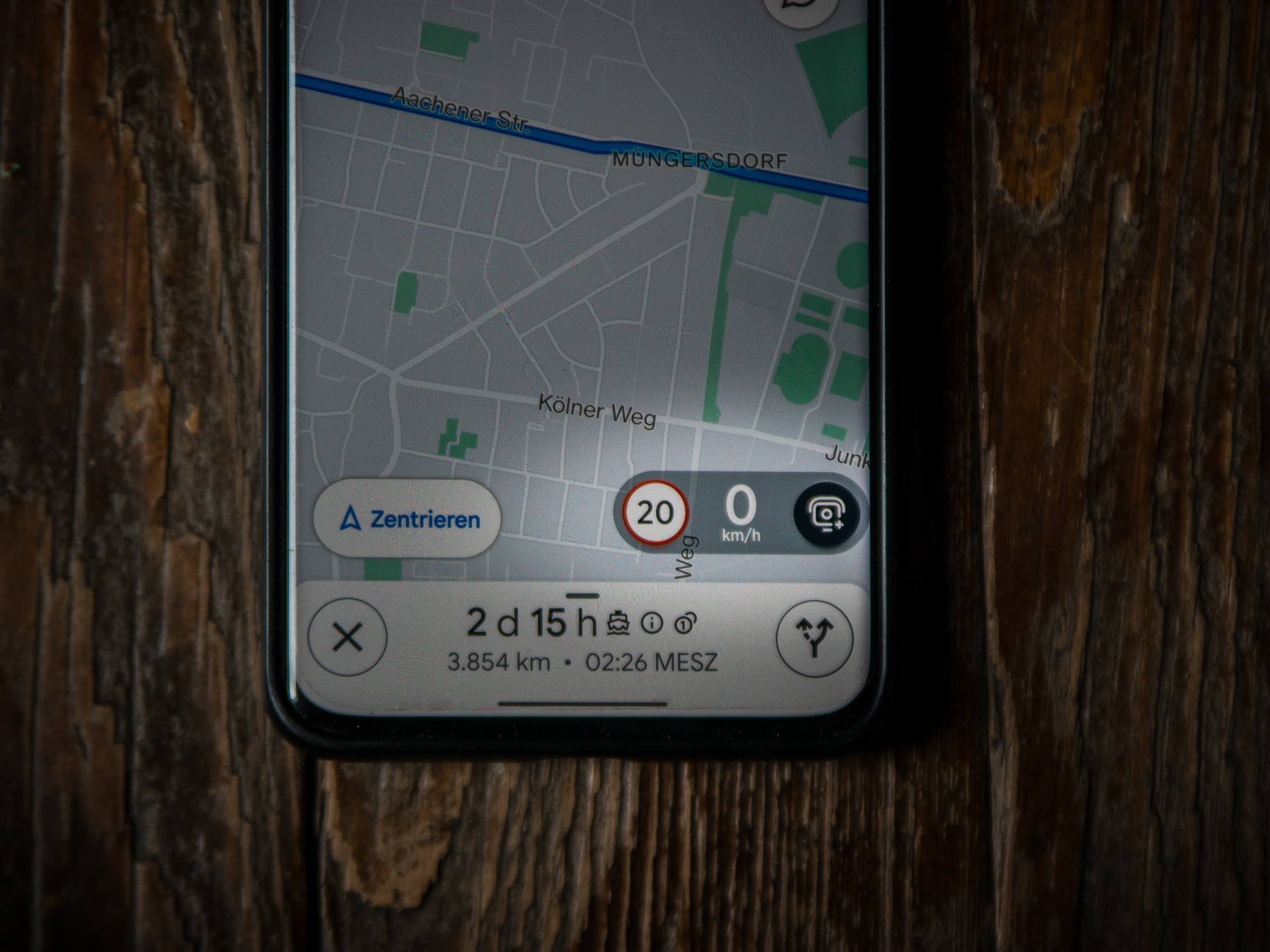
Image Image Image

In my case, it would be a floating button (kinda like the speed information Widgets in the pictures above), which expands to a little floating UI when you click on it, to quick access some further functions of the app.

On Android, an App has to get special permissions to be able to hover above other Apps.
I found something about this topic relating to cordova :

>> https://github.com/ShayShaked/cordova-p ... permission

>> https://stackoverflow.com/questions/495 ... de-the-app

Maybe you could have a look into it?
PureLust
Posts: 4
Joined: Mon Dec 09, 2024 1:50 pm

Re: Possibility question ...

Post by PureLust »

Caronte3D wrote: Mon Dec 09, 2024 8:29 pm ...
Btw, I'm doing now a GPS app for my offroad routes:
https://prnt.sc/Ek5q7CkWK0qS
WOW :shock: that looks amazing !!!

This looks like even better than I thought would ever be possible with Spider Basic.
Finally, maybe there will be a chance to write the perfect motorcycle navigation app I was dreaming of to do for years. :mrgreen:

Do you already do the routing and do navigate within your app or is it more like displaying a picture?

Maybe you will publish your code sometimes?
2.- I don't understand this point, but sounds difficult to me.
I don't think it's really so difficult. I think it's just a thing how to get the permission for the app to open it's UI above others.
The rest should be like programming a normal App/UI.
Many smartphone nowadays allow split the screen, so you can put two apps at once. May be a workaround.
That's not really a practical Option, because this will limit the other Apps (like navigation App) too much.
But a CarPlay or Android Auto Version (where the App could be next to e.g. Google Maps or Kurviger.de) would be nice indeed.
It's an app to follow gpx routes with indications turn by turn on offroad environments, so the voice indications are curve based, because I don't use roads, only narrow trails.
For Trail-Navigation I use the APP OsmAND. Originally it's made for mountain-bikers, walkers and climbers, so it can rout even the smallest trails. It can use several differente types of Map-Data. It also does the voice indication curved based, like yours.
It's really worth to have a look at ...BUT: Imho it has a terrible (totally overloaded and not intuitive) UI and it's not very stable (especially when you use it with Android Auto).

So, please keep on the great and promising work on your App and show the competitors (like OsmAND) how it's done right. :mrgreen:
Post Reply